The world we inhabit is intricate, nuanced and perpetually changing. To make informed decisions within it, governments, corporations and humanitarian organisations need highly precise digital representations of reality — and producing those, at scale, is the whole point of our mapping system.
A decade of HD vector mapping
Over nearly a decade we have grown into a globally recognised leader in AI-powered mapping. Our technology generates HD vector maps from high-resolution imagery at large scale — converting the physical world into structured, current digital intelligence, backed by a global partnership network.
One foundation, many uses
That foundational data supports a remarkable range of applications:
- Insurance underwriting and risk management.
- Transportation engineering and smart-city initiatives.
- Stormwater drainage assessment and taxation.
- Broadband infrastructure planning and deployment.
- Civil engineering, climate resilience and public-infrastructure planning.
One reliable model of the physical world, ready for the decisions that depend on it.
Sample results
Drag the slider to compare imagery and AI output.
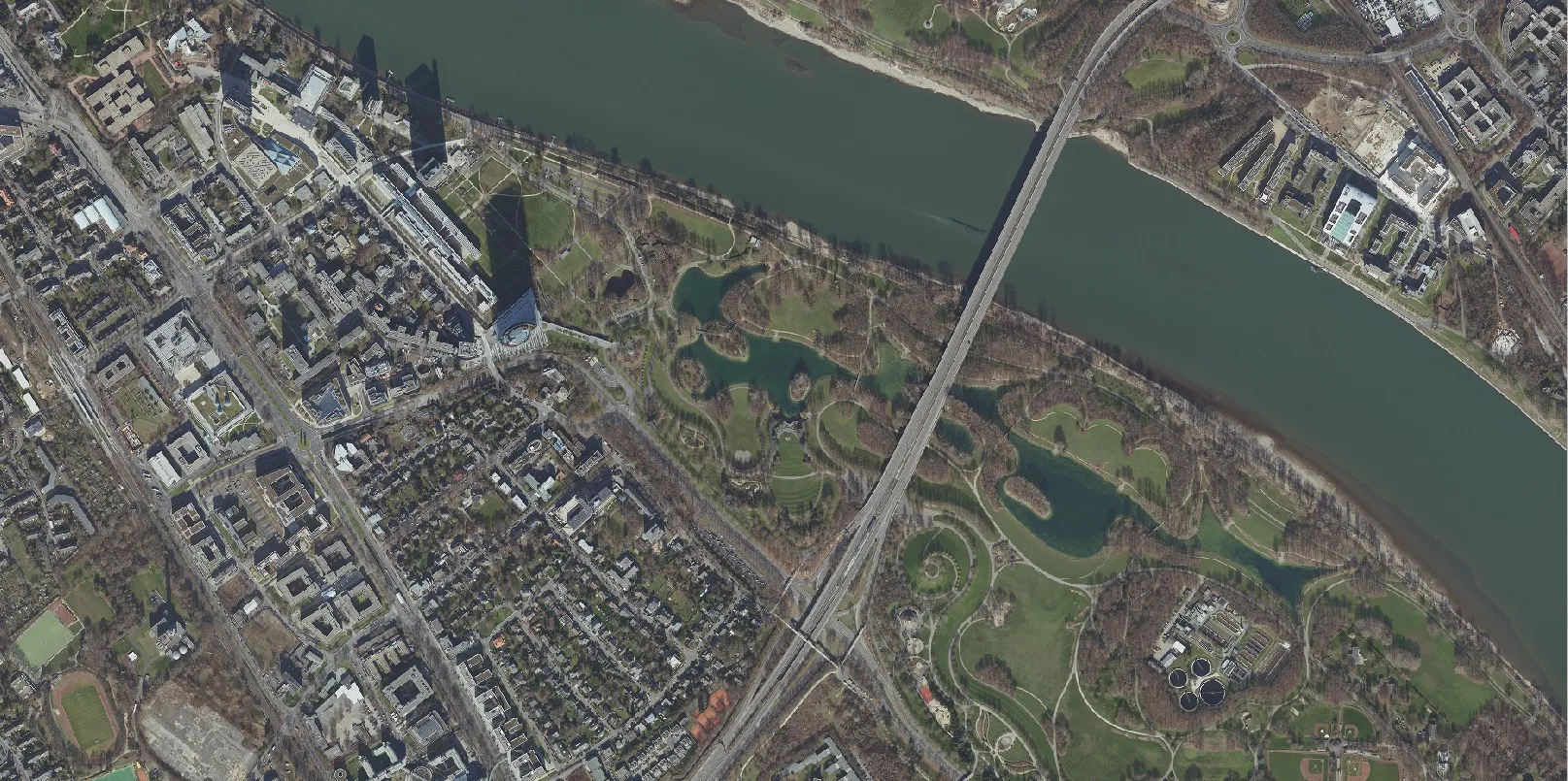
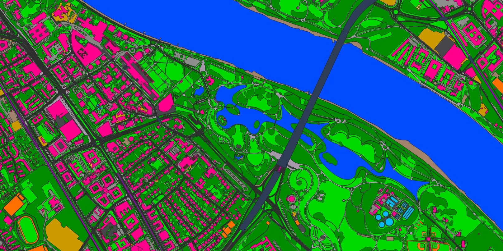 ImageMapping

