Ground truth first
Every product references the same georeferenced data, with documented accuracy. No guesswork.
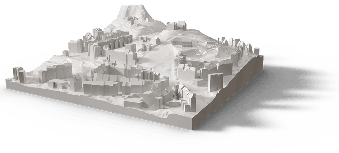
TwinPlanet is an end-to-end Earth Observation company. We bring satellite, aerial and in-situ data together with geospatial AI to turn the planet into decision-ready intelligence — from orbit all the way to underground.
The biggest challenges of our time — climate adaptation, mobility, energy, resilient infrastructure — are spatial problems. They're easier to solve when you can see the whole picture and simulate change before it happens. That's what we build.
We replace the fragmented chain of imagery brokers, AI labs, photogrammetry shops and simulation studios with one platform and one source of truth.
Every product references the same georeferenced data, with documented accuracy. No guesswork.
We deliver in open standards — GeoTIFF, CityGML, glTF, OpenDRIVE — so your data stays yours.
Our models produce evidence you can audit — essential for government, insurance and approvals.
From tasking to simulation under one roof, so nothing is lost in handoffs between vendors.
The same pipeline serves a single junction or an entire country.
Deploy in your region or on-prem; you control where data lives.
TwinPlanet is built by specialists across every stage — from tasking a satellite to shipping a navigable digital twin. Aerial-mapping experts, AI researchers and cartographers work side by side, which is exactly why nothing gets lost in the handoffs between them.
Tasking, correction and survey-grade reconstruction across satellite, aerial and drone.
The proprietary models that turn pixels into clean, attributed vectors and 3D.
CityGML, Unreal and real-time pipelines for twins, VR/XR and the metaverse.
Years of mapping craft, quality control and the data engineering to scale it.
The WebGIS, APIs and tooling that deliver everything in open standards.
Safe, precise capture on the ground and in the air, wherever a project needs it.
Want to build the living twin of Earth with us — or partner on a project?
Work with usSend us your area of interest and what you need to see. We'll return a sample over your own location and walk you through the platform.