Outcomes, not just data.
Six service lines, one platform. Pick a service or let us assemble an end-to-end workflow — everything delivered georeferenced, documented and ready for your stack.
Satellite & aerial imagery services
Tasked or archive imagery — corrected, sharpened and analysis-ready.
Explore service →Mapping services
2D, 3D, SD and HD maps — extracted by AI, georeferenced to survey grade.
Explore service →Photogrammetry services
Every classic photogrammetric product — measurable and georeferenced.
Explore service →Digital twin generation services
One living model of your territory — surface and subsurface.
Explore service →WebGIS & GIS services
Serve your maps and 3D twin in the browser — no plugins.
Explore service →3D modeling, simulation, VR & XR services
Game-engine fidelity for training, simulation and the metaverse.
Explore service →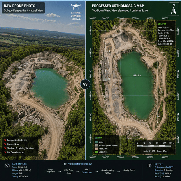
We do the hard part before you ever see it.
A raw pass is distorted, unscaled and unreferenced. What you receive is a measurable, georeferenced product with documented accuracy — ready for GIS, CAD and engineering.
- Documented spatial accuracy & RMSE.
- Consistent CRS & tiling for your basemap.
- Delivery via download, API or streamed services.
Let's map your world.
Send us your area of interest and what you need to see. We'll return a sample over your own location and walk you through the platform.