 Members only
3D digital twin
Terrain (DTM) + aerial overlay with LoD2 buildings — fly and inspect a full area in your browser.
Sign in to open →Real, interactive demos streamed from our WebGIS, Cesium and Unreal pixel-streaming. To protect them, opening a demo requires a (free) approved account — sign in or create one.
Members only
Terrain (DTM) + aerial overlay with LoD2 buildings — fly and inspect a full area in your browser.
Sign in to open →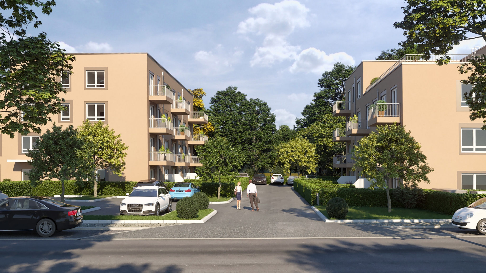 Members only
Step into a photoreal Unreal-engine crossroad and walk, drive or fly — streamed live, nothing to install.
Sign in to open →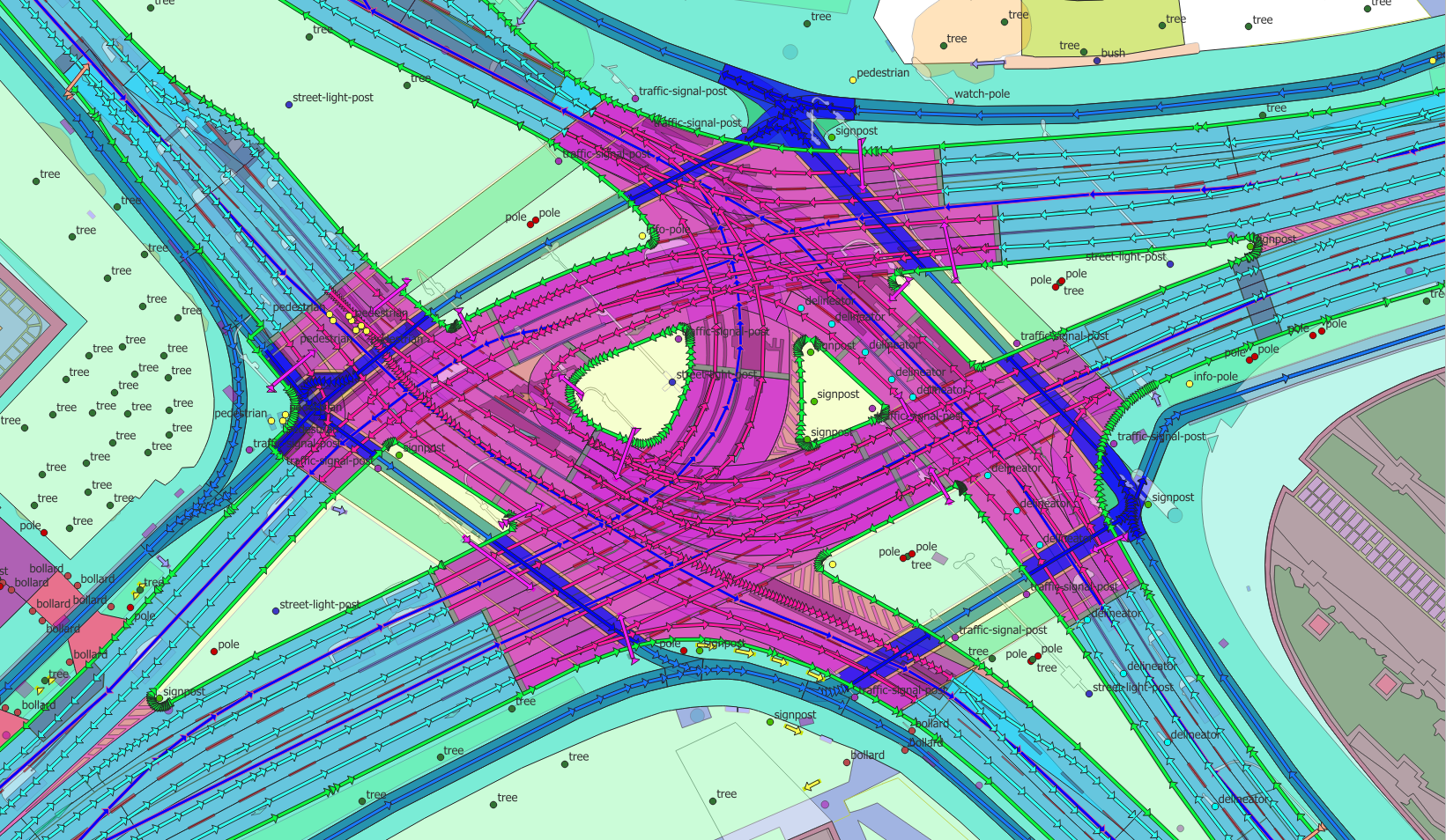 Members only
Pan a region-scale vector map served from our WebGIS — buildings, roads, land use.
Sign in to open →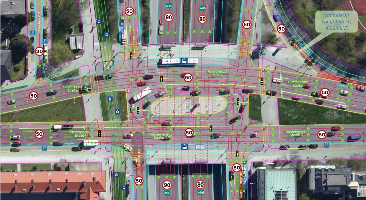 Members only
Lane-accurate HD road network with signs and markings — autonomy & simulation ready.
Sign in to open →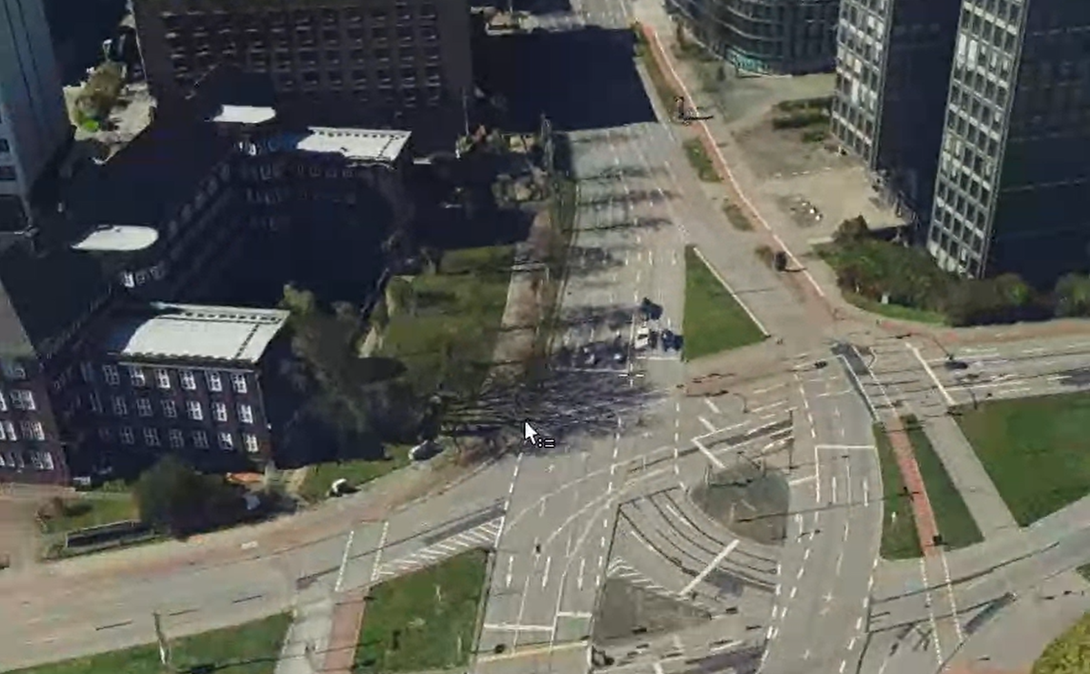 Members only
A dense, textured photogrammetric mesh of the same area — measurable, explorable in 3D.
Sign in to open →Why gated? These stream proprietary data. We grant access to verified organisations within one business day. Create an account →