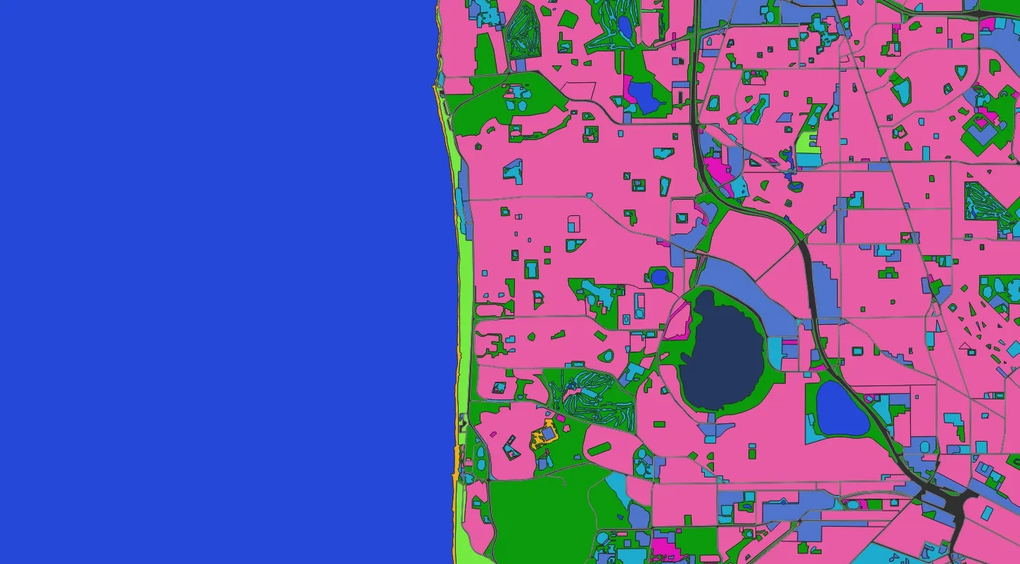
We expanded our land-cover catalogue into a far richer picture of the planet's surface — adding nuanced agricultural and natural classes such as bare soil, cultivated crops, forest, industrial, sand desert, shrubland, developed open space, transportation, urban, water, wetland, pasture, residential and wild grass.
Meaning, not just labels
What sets the approach apart is a nuanced understanding of how these land-cover types interact and evolve. The system recognises that industrial zones carry different environmental impacts than residential areas, that transport corridors create unique ecological effects, and that the interface between built and natural land matters. Classifying wetlands and water bodies alongside the new categories sharpens watershed insight — how residential areas meet water sources, how pasture affects wetland ecosystems.
Across sectors
The enhanced classification reaches many fields at once: urban planners can read the boundary between development and nature; agricultural managers can monitor the balance between cultivated crops, pasture and wild grass; environmental teams gain a finer base for tracking change over time.
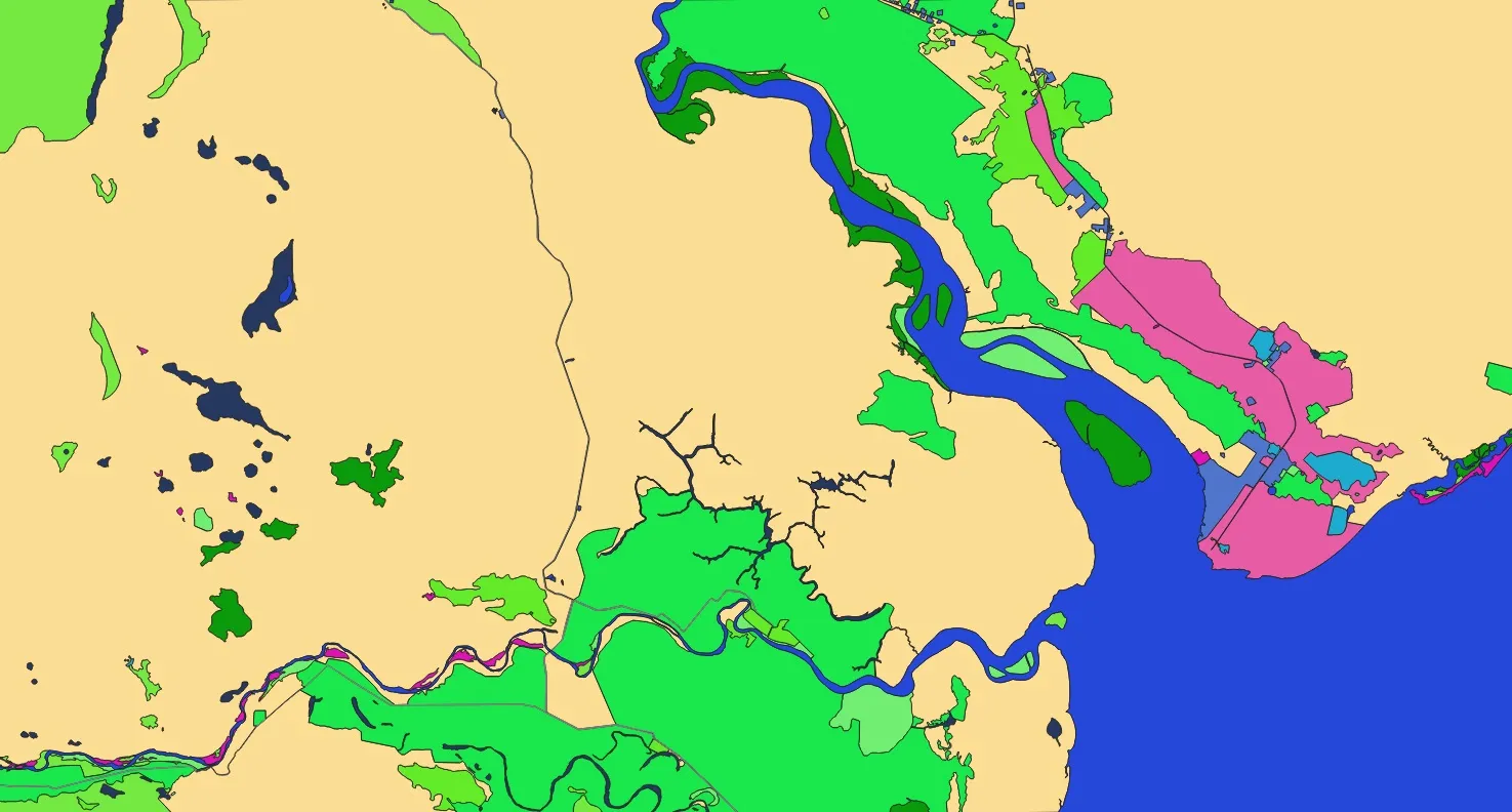
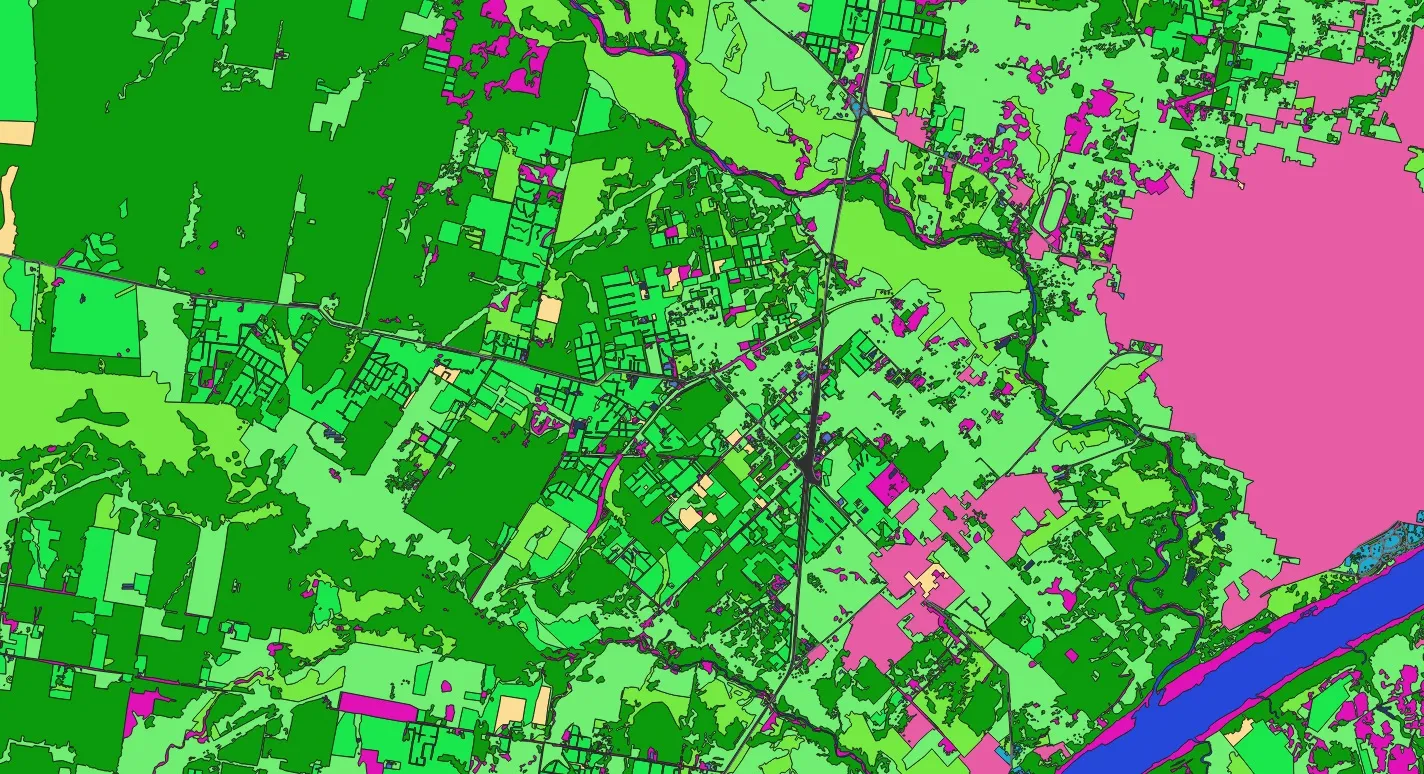
Sample results
Drag the slider to compare imagery and AI output.
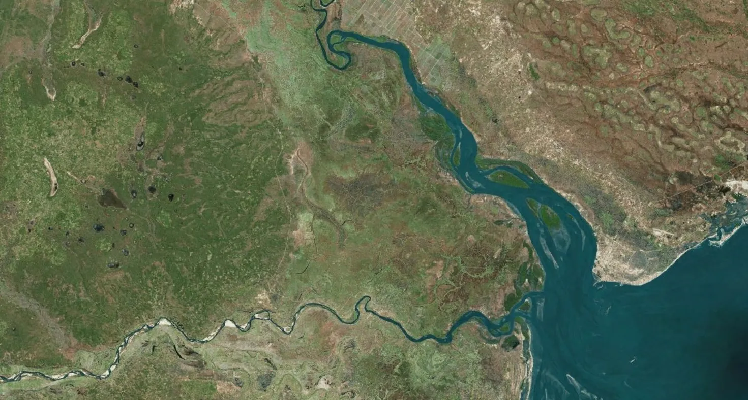
 ImageLand use
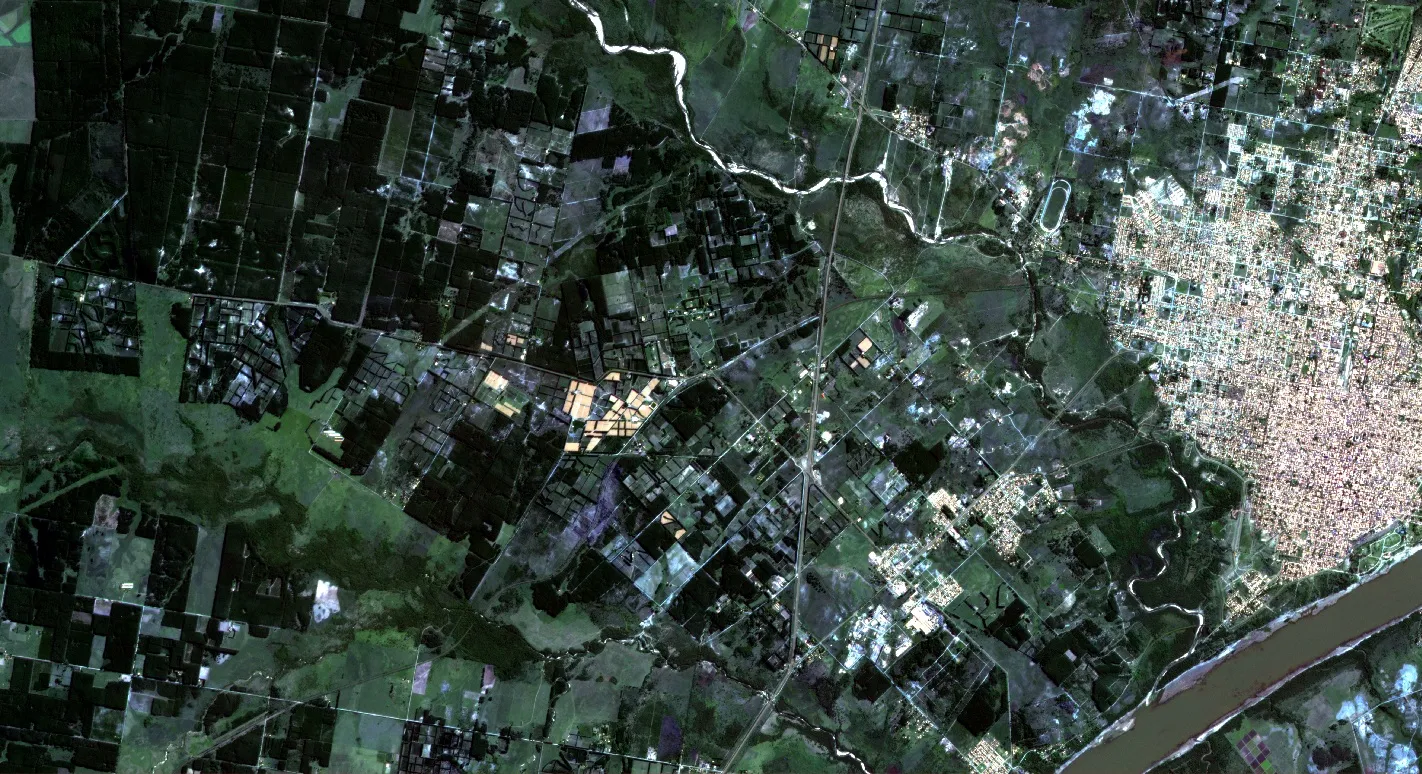
 ImageLand use
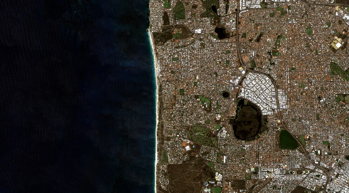
 ImageLand use

