Location: Barcelona, Spain
We deployed our AI platform over Barcelona to map land cover and transportation automatically into 13 polygon classes — a high-resolution, polygon-based inventory built for urban planning, environmental monitoring and infrastructure management. Every class, from buildings and roads to parks and railways, is delivered as a clean, attributed polygon.
The challenge
Barcelona needed a high-resolution, polygon-based land-cover inventory — and conventional methods could not provide it. Manual digitisation was slow and costly, and low-resolution land-use products simply could not separate a road from a driveway, a sidewalk from a pavement, or parking from a railway corridor. The city needed something automated and scalable.
Our approach
We combined high-resolution satellite and aerial imagery with deep-learning semantic segmentation. Each pixel is classified and then vectorised into a clean, topologically-correct polygon with full attribution — no raster masks, no loose lines. The 13 classes were:
| Class | What it captures |
|---|---|
building | Any permanent roofed structure — residential, commercial or industrial. |
road | Paved vehicular travel lanes. |
driveway | Private or semi-private access roads to houses and garages. |
water | Rivers, lakes, reservoirs, canals and fountains. |
sport-ground | Athletic fields, courts, stadiums and running tracks. |
pavement | Sealed surfaces not driven on — plazas and large paved areas. |
bridge | Elevated road or path over water, railway or a depression. |
sidewalk | Pedestrian walkways alongside roads. |
bareland | Unpaved, unvegetated soil, sand or rock. |
forest | Dense tree cover, natural or planted woodland. |
parking | Surface lots and parking structures, captured as polygon extent. |
railway | Rail corridors including track and ballast. |
grass | Lawns, meadows and grassy open space (non-forest vegetation). |
Drag the slider to reveal the AI mapping beneath the imagery.
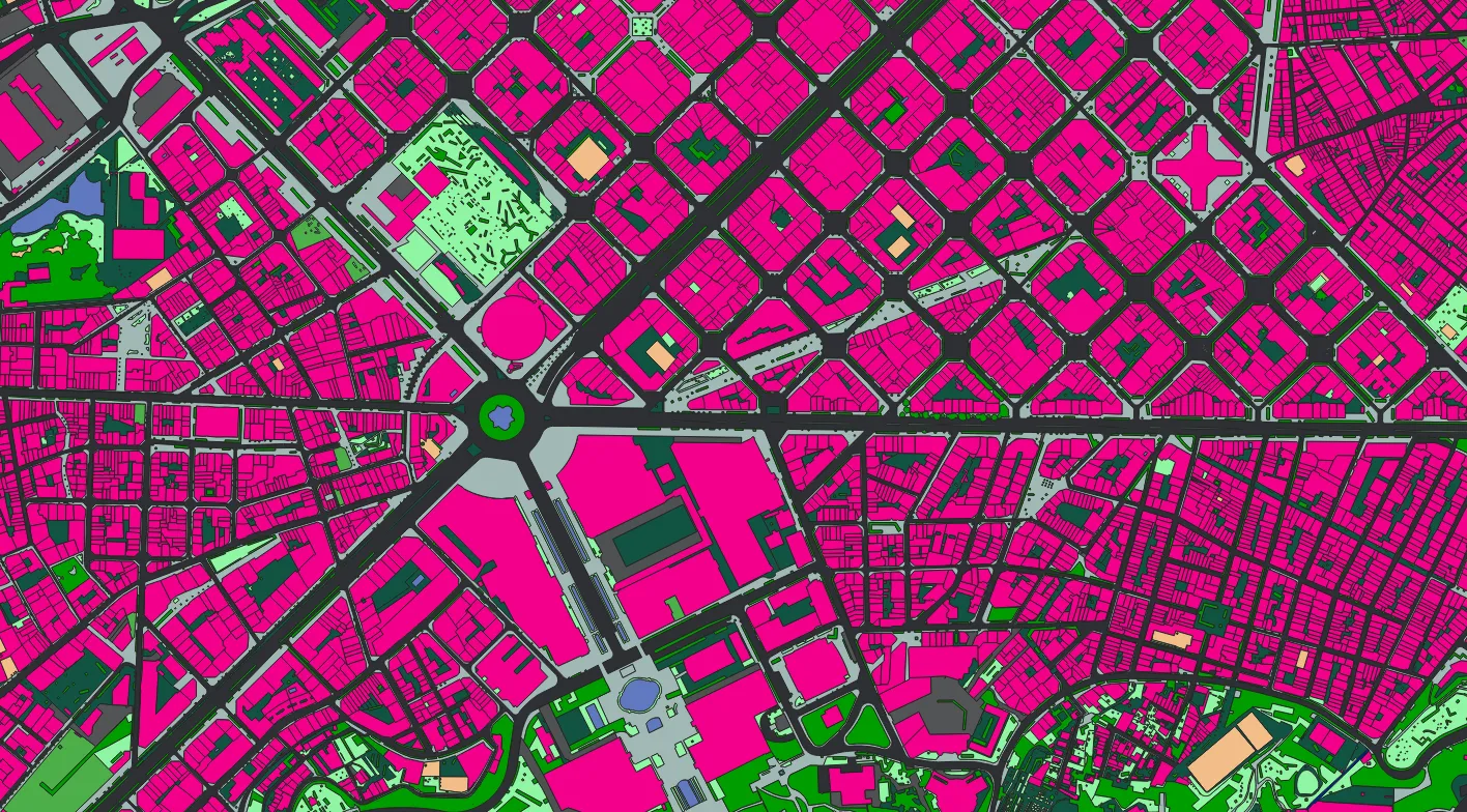
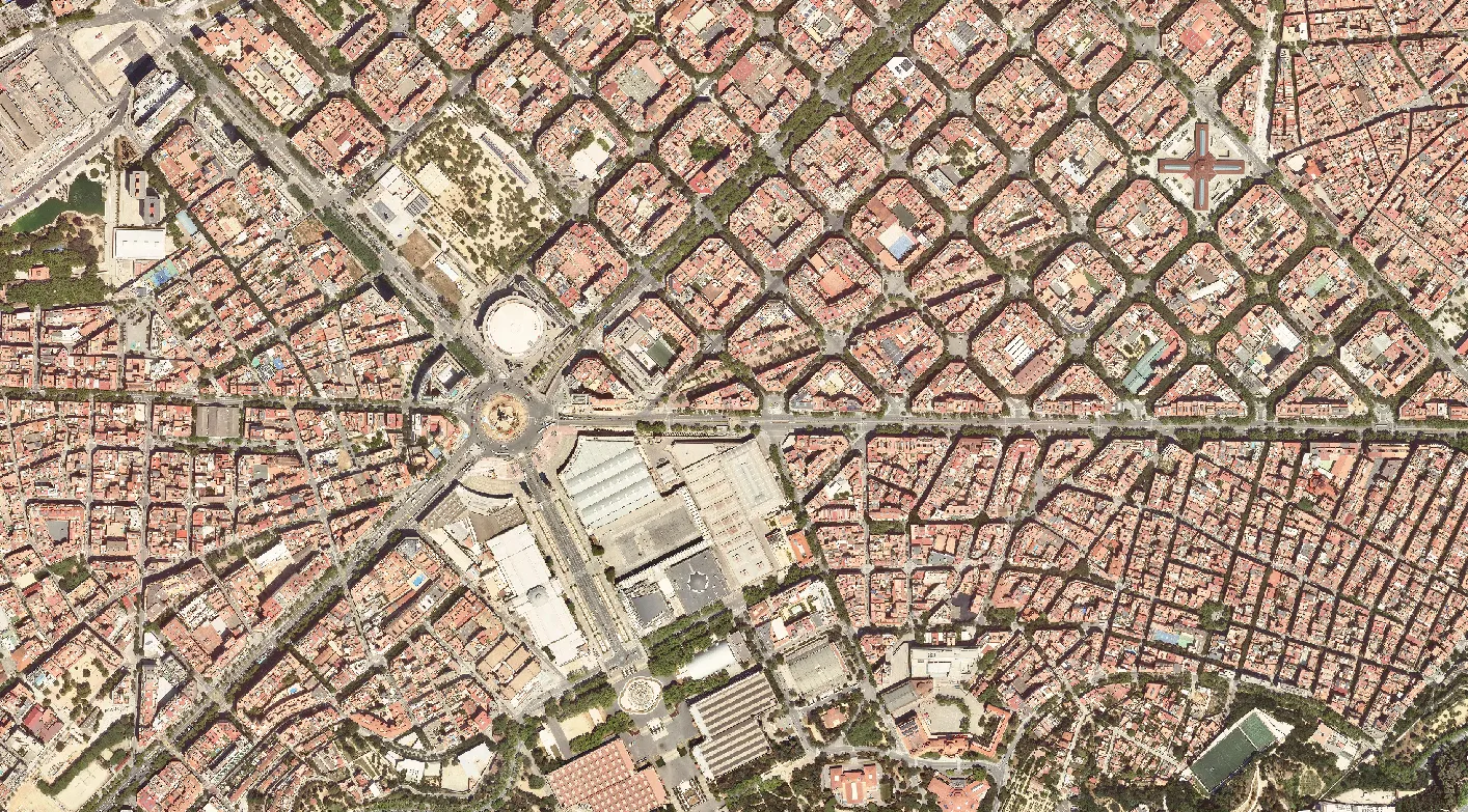 Image
Mapping
Image
Mapping
Results & benefits
- A first-time, city-wide polygon land-cover map of Barcelona with 13 detailed classes.
- Clean separation of road, driveway, sidewalk, pavement, parking and railway — precise enough for transportation-asset management.
- A clear distinction between forest, grass and bareland for environmental monitoring and green-space planning.
- An automated workflow that cut manual effort by more than 90% versus traditional digitisation.
- Polygons ready to drop straight into GIS, CAD and urban digital twins.
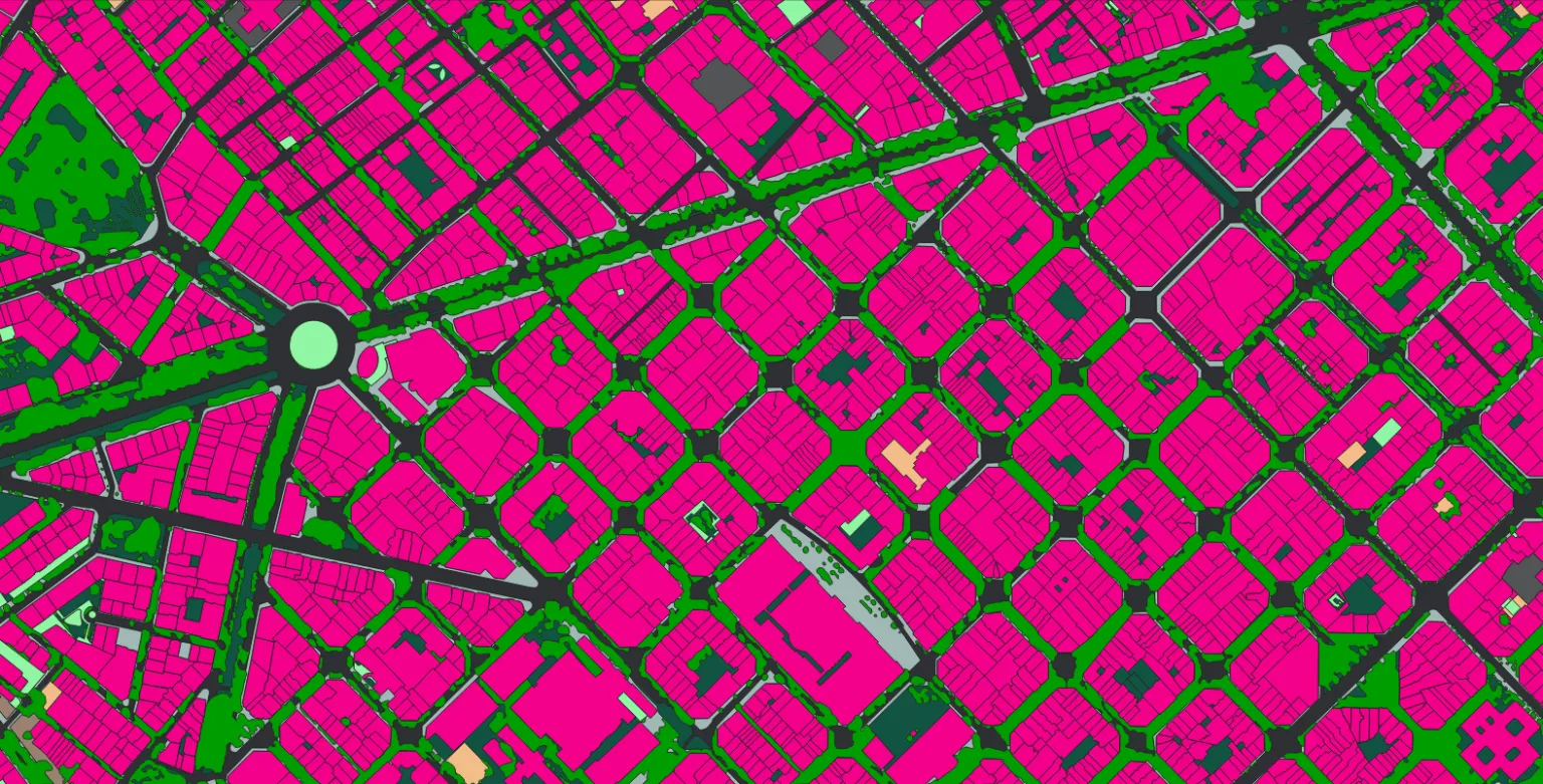
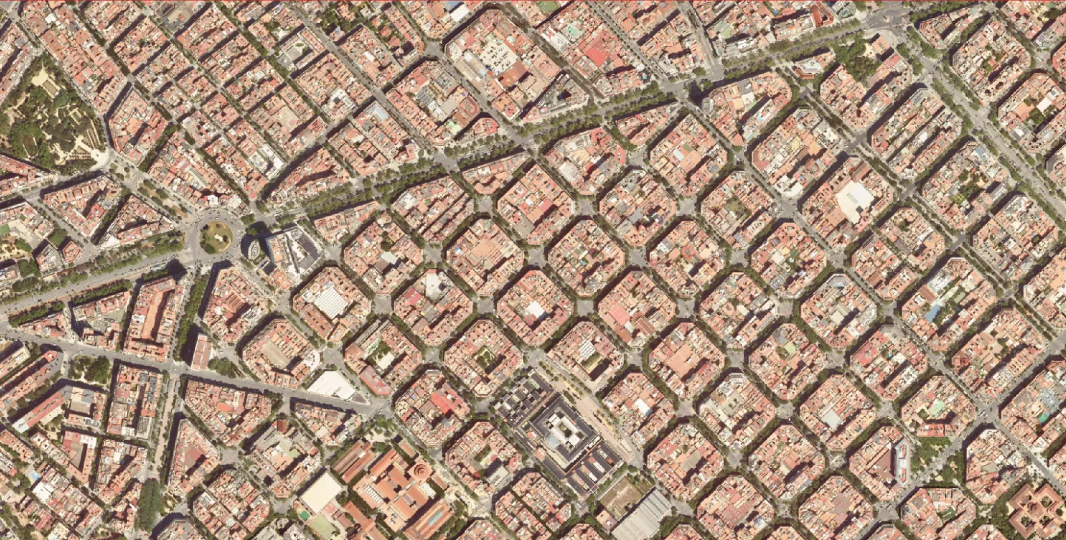 Image
Mapping
Image
Mapping
How it was built
- AI semantic segmentation — pixel-level classification of the imagery.
- Polygon vectorisation — raster masks converted to clean, topologically-correct polygons.
- Attention-based models — fine-grained separation of look-alike classes (road vs driveway vs pavement vs sidewalk).
- Geospatial attribution — class name, area in m² and perimeter on every feature.
Delivery
Polygons only, fully attributed, in the open formats your stack already speaks: Shapefile (.shp), GeoJSON and KML/KMZ.


